ALBUQUERQUE, NM — A flood watch is in effect across most of New Mexico as monsoon moisture pushes into the state and sets up the chance for widespread heavy rain. The National Weather Service says flash flooding is likely in some places, with river and creek flooding also possible.
Rain could become intense enough to overwhelm drainage and runoff systems, especially where storms repeatedly move over the same areas. The watch includes Albuquerque and Santa Fe, and forecasters say the wet weather could persist through Wednesday afternoon.
Heavy rain could exceed 1.5 inches in parts of the state
Forecast totals may top 1.5 inches by Wednesday afternoon along and east of the central mountains. That amount alone can create problems when rain falls quickly or over ground that is already saturated.
Stronger storms could produce rain rates of 2 inches per hour. The National Weather Service also warns that some storms may “train,” meaning they repeatedly track over the same locations and drop heavier totals in a short period of time.
Some areas could pick up more than 4 inches from repeated storms
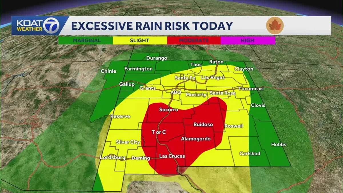
The most persistent storms could deliver locally heavy rain amounts above 4 inches across southern, central and eastern New Mexico. Forecasters say those totals would be enough to create dangerous runoff in flood-prone terrain.
When storms linger or move over the same corridor, water can rise quickly in low spots and overwhelm normally dry channels. That pattern is especially concerning in places where drainage is limited or where roads cross washes and arroyos.
Burn scars, low water crossings and urban areas face the highest risk
The National Weather Service says rapid runoff and flash flooding will be most likely below burn scars, in low-lying areas, arroyos, cities and neighborhoods near streams and rivers. Those are the places where water can collect and move with little warning.
Some streams may rise out of their banks, creating a wider flood threat than a typical heavy-rain event. The watch also highlights the risk to creek beds and other flood-prone locations that can fill quickly during intense storms.
Watch covers 31 counties, with only Curry and Roosevelt left out
The flood watch applies to 31 of New Mexico’s 33 counties. Curry and Roosevelt counties are the only ones not included in the alert.
That means the threat stretches across most of the state rather than staying confined to one region. Residents in the affected counties should pay close attention to changing weather conditions, especially if storms begin to intensify or repeat over the same area.
What the weather pattern means for Albuquerque and Santa Fe
Albuquerque and Santa Fe are both included in the watch, putting two of the state’s largest population centers under the threat of flooding. In urban areas, even brief downpours can quickly overload storm drains and cause ponding on streets.
The combination of monsoon moisture and training storms could also lead to sudden rises in nearby arroyos and waterways. Drivers and residents in the metro areas are being urged to stay alert for changing conditions, especially in low spots and near flood-prone crossings.
How residents can follow updates as storms move in
The National Weather Service continues to monitor the situation as the monsoon surge moves through the state. Because flood watches are designed to give advance notice, conditions can change quickly if heavier storm bands develop.
Weather officials advise people to keep up with the latest alerts and watch for any flood warnings that may follow. KOAT is also directing viewers to its weather tools and app for current conditions, radar and alert updates.