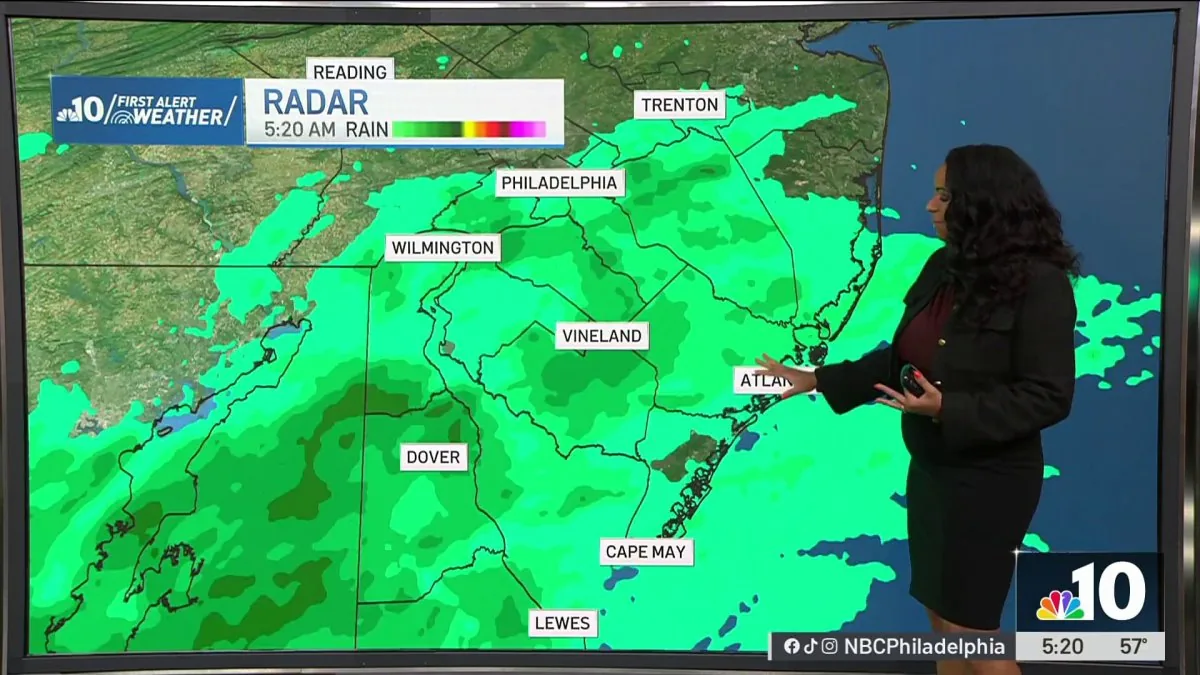
PHILADELPHIA, PA — A coastal storm is set to keep the Philadelphia region cool, breezy and unsettled through the end of the week, with the main concern shifting to tidal flooding along the Delaware River and other tidal waterways.
The National Weather Service says a First Alert is in effect for strong wind gusts, coastal flooding and beach erosion. The weather pattern is expected to bring repeated impacts to shore areas while water levels stay elevated around high tide.
Wednesday brings mostly cloudy skies, gusty northeast winds and a high near 68 degrees. Forecasters say wind gusts around 30 mph could make it feel cooler at times and create problems along shoreline communities.
Gusty northeast winds are expected to drive the coastal impacts
The system is being fueled by persistent northeast winds, which will continue to push water into tidal areas and keep conditions rough for coast-facing communities. That wind direction is one of the main reasons forecasters are watching for flooding near the Delaware River and nearby waterways.
Winds around 30 mph on Wednesday are expected to be the strongest of the period mentioned in the forecast, and those gusts can make travel and outdoor activity feel less comfortable, especially near the coast. The breezy pattern also adds to concerns about erosion along the beach.
While the region is not expected to see a major warmup, the combination of wind and high tides is enough to create repeated nuisance flooding issues in vulnerable spots. Officials are focusing on low-lying shoreline areas where water can come up faster than usual.
Coastal Flood Advisory begins Wednesday night and lasts into early Friday
The Coastal Flood Advisory for Philadelphia and nearby tidal communities starts Wednesday night and continues into early Friday. That timing means multiple high-tide cycles may be affected before the coastal low finally weakens or shifts away.
Forecasters say additional rounds of flooding are possible while the system lingers. The impacts are expected to be most noticeable in places that already tend to flood during higher-than-normal tides.
This kind of advisory usually signals that flooding is likely enough to cause minor disruptions, even if it does not reach the level of a more serious flood warning. For residents near tidal waterways, the key concern is that water could briefly cover streets or low-lying access points around tide peaks.
Thursday stays cool and dry-looking, but water levels remain a concern
Thursday’s forecast calls for mostly sunny conditions with a high near 68 degrees, but the calmer-looking sky does not mean the flood risk is gone. The northeast wind is expected to keep pushing water into tidal zones through the day.
That means shoreline flooding could continue even without rain. In coastal weather setups like this one, the tide and wind can matter more than what is falling from the sky.
Residents in flood-prone neighborhoods should keep an eye on timing around high tide, especially if they live near creeks, bays or riverfront streets. The National Weather Service says the risk remains tied to the lingering coastal low and the steady onshore flow.
Friday brings a little more sunshine, but another round of flooding is possible
By Friday, conditions are expected to improve somewhat, with more sunshine and temperatures near 74 degrees. Even so, forecasters say another round of coastal flooding is possible around high tide.
The areas most likely to be affected are vulnerable low-lying locations, where even a modest surge of water can cause inconvenience or short-lived closures. The lingering storm pattern means the flooding threat does not end immediately when the skies brighten.
That possibility is important for residents who commute, work near the waterfront or live in neighborhoods that have flooded in past coastal events. The forecast suggests the worst impacts should remain limited, but repeated tidal issues may still be a problem through the early part of Friday.
Beach erosion and shore impacts are part of the First Alert setup
Along with flooding, the First Alert highlights beach erosion as another concern for the region’s shorelines. Strong onshore winds can strip sand from beaches and make coastal conditions less stable, especially during a prolonged storm setup.
That combination of gusty wind and higher water levels can be disruptive even when rain totals are not especially high. The concern is less about one major storm surge and more about a stretch of unsettled weather that keeps tide-sensitive areas under pressure.
For people along the coast, that means paying attention to both the forecast and local conditions near the water. The National Weather Service is signaling that the hazard is not isolated to one moment, but may repeat until the coastal low weakens and tidal flooding chances fade.