HONOLULU, HI — Tropical Storm Nolo has formed south of Hawaiʻi, and forecasters say it could strengthen into a hurricane by Thursday. The National Weather Service has issued a Hurricane Watch for Hawaiʻi County, signaling that hurricane conditions are possible as the storm approaches the islands.
At the moment, Nolo is still well south of the Big Island, but it is moving in a direction that could bring it closer late this week. Officials say residents should pay close attention to forecast updates, since the storm is expected to remain a serious threat to wind, rain and surf conditions across parts of Hawaiʻi.
Storm location, movement and current strength
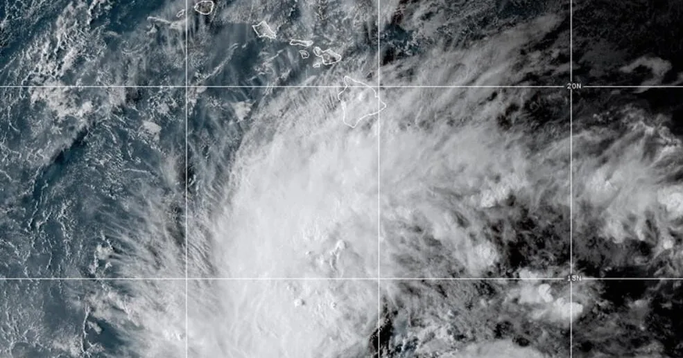
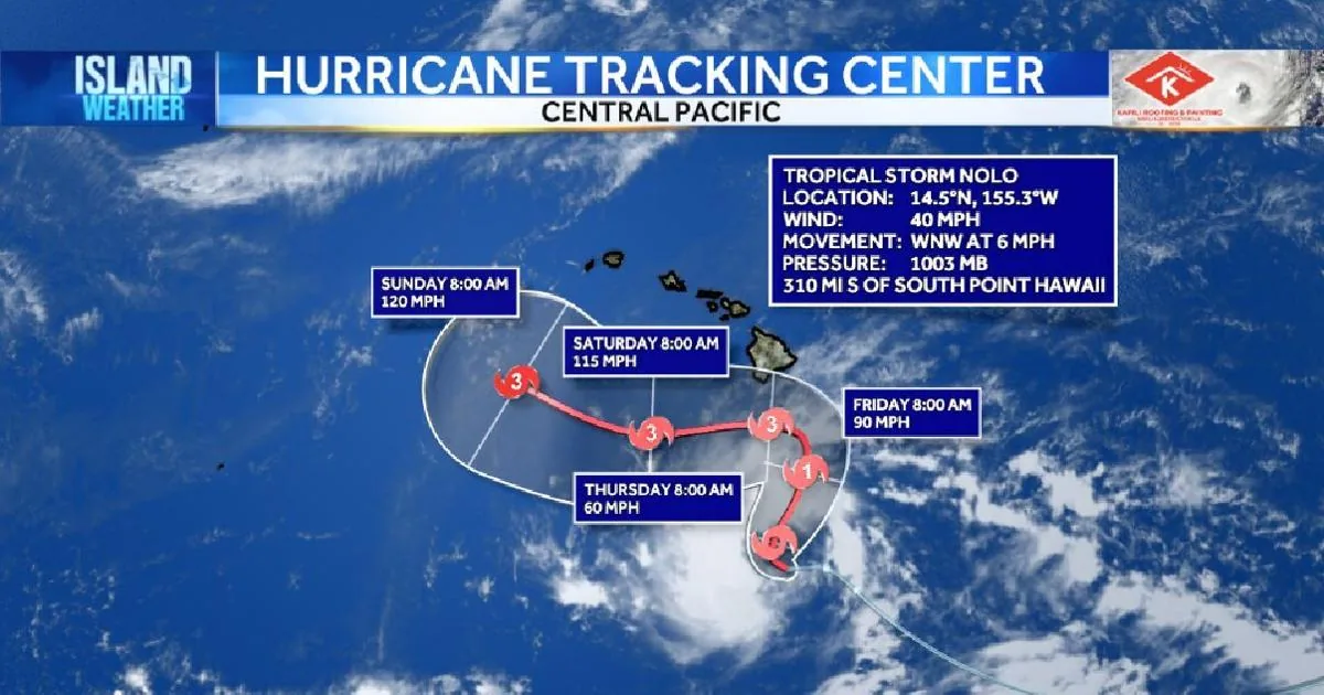
Nolo is located about 310 miles south of South Point on the Big Island. It is traveling west-northwest at about 6 mph, with maximum sustained winds near 40 mph.
Forecasters expect the system to turn north and then north-northeast Thursday. That track would bring the storm toward the Big Island Friday and Saturday, though the exact path could still change as Nolo organizes and strengthens.
The forecast call for intensification is one of the main reasons officials are urging people to stay alert. A storm that starts as a tropical storm can become much more dangerous if it rapidly gains wind speed before it reaches the islands.
Hurricane Watch covers Hawaiʻi County as conditions may arrive Friday night
A Hurricane Watch is now in effect for Hawaiʻi County. The designation means hurricane conditions are possible within the watch area, not that such conditions are happening yet.
Forecasters say hurricane conditions could begin as early as Friday night. That timing gives residents a limited window to prepare, especially in areas that could face strong winds, flooding or hazardous surf if Nolo’s track holds.
Officials have not said the watch is a guarantee of landfall, but it does indicate that the Big Island is close enough to the projected path for dangerous weather to become a real concern.
Heavy rain could trigger flooding and mudslides on the Big Island
The heaviest rain threat is focused on the Big Island, where Nolo could produce 15 to 20 inches of rain. Some areas could see as much as 35 inches if the storm slows or tracks in a way that favors stronger rainfall.
That amount of rain could lead to life-threatening flooding and mudslides, especially in steep terrain. The risk is highest where slopes, valleys and drainage channels can quickly funnel water into dangerous conditions.
Maui may also see significant rainfall, with totals of 5 to 10 inches possible and higher amounts not ruled out. Other islands could receive 1 to 3 inches, with isolated flooding possible in vulnerable locations.
Wind, storm surge and coastal flooding remain major concerns
Strong winds are another major hazard as Nolo moves closer to the islands. Forecasters say the storm could become a hurricane, which would raise the risk of damaging wind across exposed areas.
Storm surge could also cause coastal flooding along the Big Island. In some areas, water levels could rise 1 to 3 feet above ground, creating dangerous conditions near shorelines, low-lying roads and coastal properties.
Because storm surge can arrive with little warning and move water farther inland than expected, officials are warning residents near the coast to watch for changing conditions and act quickly if local guidance changes.
Surf and rip currents are expected to increase through the weekend
Surf is forecast to build along east- and south-facing shores of the Big Island starting Friday, then spread westward through the weekend. As the storm evolves, dangerous breakers could affect beaches and shoreline access across more of the island.
Along with large waves, dangerous rip currents are possible. That combination can make ocean conditions hazardous even for people who are familiar with local beaches and normally calm areas.
Residents and visitors are being urged to avoid taking chances near the water while the storm passes. Changes in surf and current conditions can happen quickly as the system strengthens and its track becomes clearer.
Officials urge residents across Hawaiʻi to follow the forecast closely
Forecasters say everyone across Hawaiʻi should keep monitoring updates as Nolo continues to strengthen and its path becomes more certain. The storm’s size, speed and eventual turn north will help determine how much rain and wind different islands receive.
For now, the main message from officials is to stay informed and be ready for worsening weather later in the week. The Big Island faces the greatest threat, but nearby islands are also likely to see impacts from rain, wind and rough surf.
As with any approaching tropical system, the details can change quickly. That is why weather officials are emphasizing frequent forecast checks rather than waiting until conditions start to deteriorate.