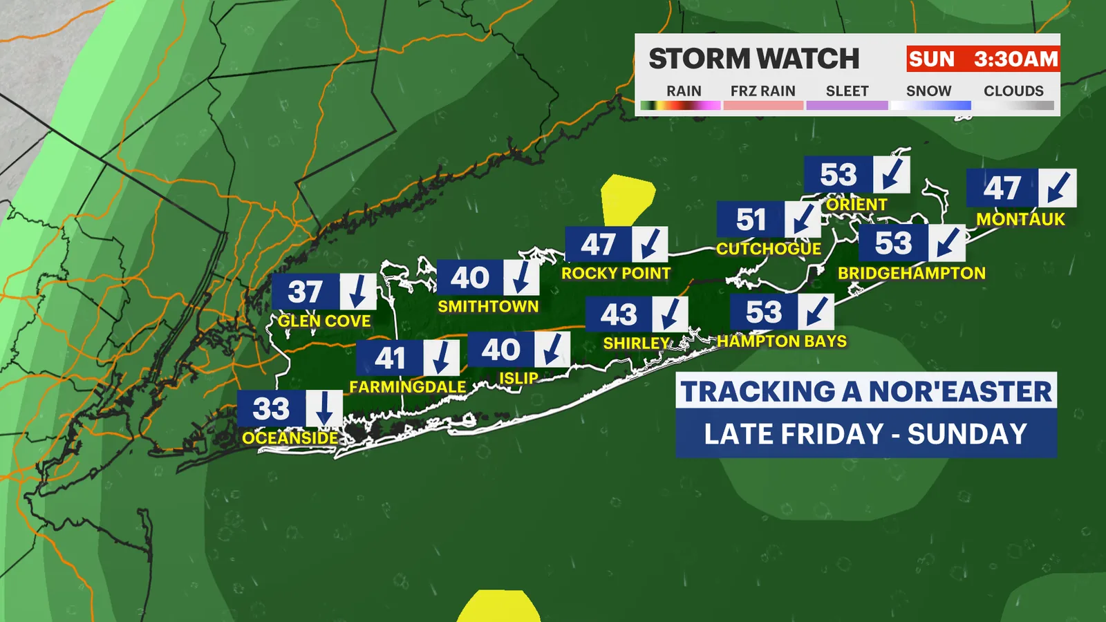
LONG ISLAND, NY — Long Island is already seeing the first impacts of a developing nor’easter, with dangerous ocean waves and minor coastal flooding around high tide. Those conditions are expected to intensify from Thursday into the weekend as the storm strengthens offshore.
The biggest questions remain tied to the storm track, which will determine how strong the wind, rain and coastal flooding become in Nassau and Suffolk counties. Weather forecasters are urging residents to plan for a wet, windy stretch and to keep checking for updates as the system develops.
Because offshore storms can shift quickly, even a small change in the track could make a major difference for the region. The forecast calls for the most serious impacts late Friday through Sunday, when rough surf, flooding at high tide and power outages become more likely.
Coastal flooding begins before the weekend
Coastal flooding is already being reported during high tide, and that threat is expected to continue through the weekend. Nassau County is facing likely coastal flooding during high tide periods from Thursday evening into the weekend, while Suffolk County is dealing with coastal flooding and beach erosion from today into the weekend.
Officials are warning that surf conditions will remain dangerous as the storm stays offshore. The combination of strong onshore winds and elevated waves can push water onto vulnerable shoreline areas, especially during high tide cycles.
Residents along the shore should expect water to run higher than usual in low-lying coastal spots. The risk is not just for property near the water, but also for roads and access routes that can become difficult to use when tides peak.
Nassau County braces for a windy, wet stretch
Nassau County’s forecast points to a stretch of mostly cloudy and windy weather beginning Friday. Gusts are expected to reach 30 to 35 mph, with only a slight chance of showers late in the day.
By Saturday, the system is expected to become more noticeable, with mostly cloudy skies, a chance of morning showers and steadier rain arriving toward evening. Wind gusts could again reach 30 to 35 mph, with some gusts near 40 mph possible.
Sunday could bring cloudy skies, periods of rain and less than 1 inch of rainfall. Gusts around 30 to 35 mph are expected, keeping the coastline unsettled and limiting any quick improvement in conditions.
Suffolk County faces the strongest wind and rain risk
Suffolk County is expected to take the brunt of the storm’s windier side. Forecasts call for north-northeast gusts of 30 to 40 mph on Friday, along with a chance of a few late-day showers.
The stronger impacts are expected Saturday, when rain should become more widespread in the afternoon and moderate rain is possible by evening. Wind gusts could reach 35 to 45 mph, raising the chance for downed limbs and scattered outages.
Sunday may be the most active day, with cloudy skies, periods of rain and some pockets of heavy rain. Rain totals are forecast to reach 1 to 2 inches, and gusts could still run 30 to 45 mph.
Power outages could increase late Saturday into Sunday
Forecasters say the strongest winds may arrive late Saturday and continue into Sunday, when gusts could exceed 40 to 50 mph in some areas, mainly in Suffolk County. That level of wind can make travel more difficult and may bring scattered power outages.
The weather team says the storm’s exact strength is still being refined as better data comes in later in the week. For now, the main concern is that the system will remain close enough to generate damaging wind gusts without making a direct landfall.
Any change in track to the west or east could alter how severe the impacts become. That uncertainty is why officials are urging people not to wait until the last minute to prepare.
Weeklong forecast turns from stormy to calmer by Monday
Conditions are expected to stay unsettled through Sunday night, with showers possibly lingering early Monday. After that, forecasters expect some improvement as sun begins to break through.
Monday’s forecast calls for highs around 68 degrees, followed by mostly sunny conditions on Tuesday and Wednesday with highs near 70 degrees. Overnight lows are expected to remain in the 50s through much of the period.
Before that calmer stretch arrives, the immediate focus remains on coastal flooding, beach erosion, strong surf and wind gusts strong enough to disrupt power and daily routines. The forecast suggests the storm will continue influencing the region for several more days before moving away.
Forecasters urge residents to keep checking updates
The News 12 Storm Watch team says people should follow on-air coverage, social media and the News 12 app for frequent updates as the nor’easter strengthens offshore. Forecasters also point residents to tide and shoreline forecasts through the weekend.
That guidance is especially important because the storm’s effects are tied closely to timing. High tide periods could bring the worst flooding issues, while the strongest gusts may occur late Saturday and Sunday.
With conditions still evolving, residents across Nassau and Suffolk counties are being told to prepare for wind, rain and coastal flooding rather than assume the storm will stay offshore without consequences. Even if the center stays well out to sea, Long Island is likely to feel several of its most disruptive effects.