BOSTON, MA — A developing early-fall nor’easter is moving toward Massachusetts and is expected to bring a prolonged stretch of rain, strong wind and coastal concerns through the weekend. WBZ’s NEXT Weather team has issued a Weather Alert for the Boston area as the storm organizes offshore and begins to turn north.
The weather system is expected to affect coastal communities the most, with the heaviest impacts focused on southeastern Massachusetts, Cape Ann, Cape Cod and the islands. Areas farther inland, especially west of I-95, should still see unsettled conditions, but the impacts are expected to be less severe. Forecasters say the storm will be slow-moving, which raises the chance for several rounds of rain and wind over more than three days.
Rain begins Friday night and lingers into Monday
The first rain is expected to reach extreme southeastern Massachusetts Friday evening and overnight. From there, a heavier band of rain should spread north and west Saturday morning and eventually cover most of southern New England.
Forecasters say the setup will keep the region “in the soup” for much of the weekend. Periods of rain are expected to continue through Sunday and into Monday, with the storm finally winding down late Sunday and then ending by Monday evening or overnight. The long duration is one reason the event is being watched closely, even though it is not expected to produce extreme totals everywhere.
The storm center is expected to slow significantly and may even drift back toward the Massachusetts coastline, a pattern that can prolong the wet and windy weather. That slow motion is also why impacts could continue well after the first bands of rain arrive.
Forecast rain totals favor the coast and southeast Massachusetts
Most of the area is expected to receive between 1 and 3 inches of rain from the nor’easter, with the highest totals most likely closer to the coast and across southeastern Massachusetts. Locations farther west and inland, especially west of I-95, should see lighter amounts.
Some isolated spots in far eastern areas could pick up 3 to 6 inches, though that is not expected to be the norm. Even so, forecasters say that heavy rain falling in a short period could still lead to localized street flooding.
Because Massachusetts has been dealing with drought conditions, the ground can absorb some rainfall. Still, the concern is not just how much rain falls, but how quickly it arrives. At this point, major river flooding is not expected.
High Wind Watch covers the coast with strongest gusts on Cape Cod and the islands
The National Weather Service has issued a High Wind Watch for coastal areas Friday and Saturday. Winds are expected to strengthen first along the shoreline and then spread across the region as the storm matures.
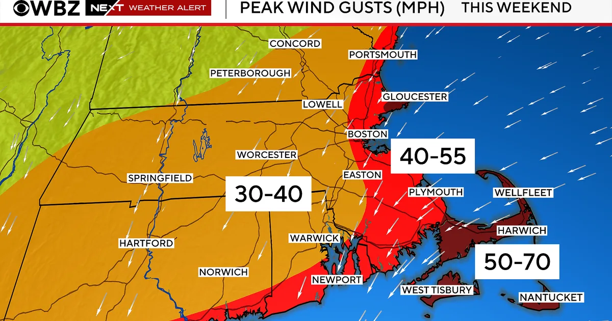
Forecasters say northeast gusts could reach 50 to 70 mph on Cape Ann, Cape Cod and the islands. Other coastal locations are expected to see gusts around 40 to 55 mph. Inland areas west of I-95 should generally see lower impacts, with peak gusts in the 30 to 40 mph range.
The strongest wind is expected from Friday night through Saturday night before gradually weakening and shifting direction on Sunday and beyond. The timing raises the possibility of scattered power outages in the hardest-hit coastal areas, especially during the period of peak wind late Friday through late Saturday.
Coastal Flood Watch targets the high-tide cycles Friday and Saturday night
The National Weather Service has also issued a Coastal Flood Watch for Friday night and Saturday night high tides. Forecasters expect most flooding to be minor, but some shoreline roads could see closures and water could reach up to 1 foot in low-lying coastal spots.
The highest concern is for the tide cycles that occur just before midnight Friday and Saturday, when onshore winds are expected to be strongest. That timing can push water into vulnerable shoreline areas and create brief but disruptive flooding near the coast.
Tides are expected to rise astronomically into Sunday and early next week, but by then the wind should be turning and easing. That shift should limit additional coastal flooding even though the tides themselves remain elevated.
Forecast models differ on the storm track and final impacts
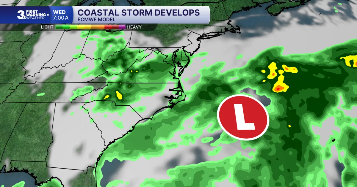
There is still significant model disagreement about exactly how the nor’easter will track. The two main medium-range models point to different solutions, and that difference could change how hard Massachusetts is hit.
The American GFS model brings the storm along a more traditional nor’easter path near or over Cape Cod. The European model pushes it farther west toward New York City, which would alter the wind direction in southern New England and could reduce the overall impact from wind and coastal flooding.
For now, forecasters are leaning slightly toward the GFS idea of a more classic nor’easter. Because the final track is still uncertain, officials are urging residents to keep an eye on frequent forecast updates from the WBZ-TV NEXT Weather team as conditions evolve.